SCOTLAND TOUR 2023
PART ONE.
IN MAY, 2023 WE PLANNED A 1,500 MILE ROAD TRIP IN OUR CARAVAN, AROUND THE WEST COAST OF SCOTLAND AND THE ISLE OF SKYE. WE AVOIDED MIDGES, AND HAD ONLY ONE AND A HALF DAY'S RAIN IN ALMOST A MONTH. WE TICKED ALL OUR 'MUST DO' BOXES, AND THIS IS THE BLOG OF THAT FANTASTIC TRIP.
Yes, this is a BIG blog (well, we WERE there for a whole month, and had good weather - so the amount of pics reflect that).
The middle section is devoted to our two weeks on Skye, which is an absolutely mind-blowing place.


.....and so - we set off..........


PART TWO
OBAN, McCAIG'S TOWER,
PORT APPIN AND LISMORE.
After settling in at the seaview site, we went to explore Oban.


PORT APPIN AND LISMORE ISLAND.
PEACE AND TRANQUILITY.
Port Appin was a bit of a drive, but that's one thing about driving in rural Scotland - it's an absolute DELIGHT! There is very little traffic, and it's just like stepping back in time to when I first started driving.
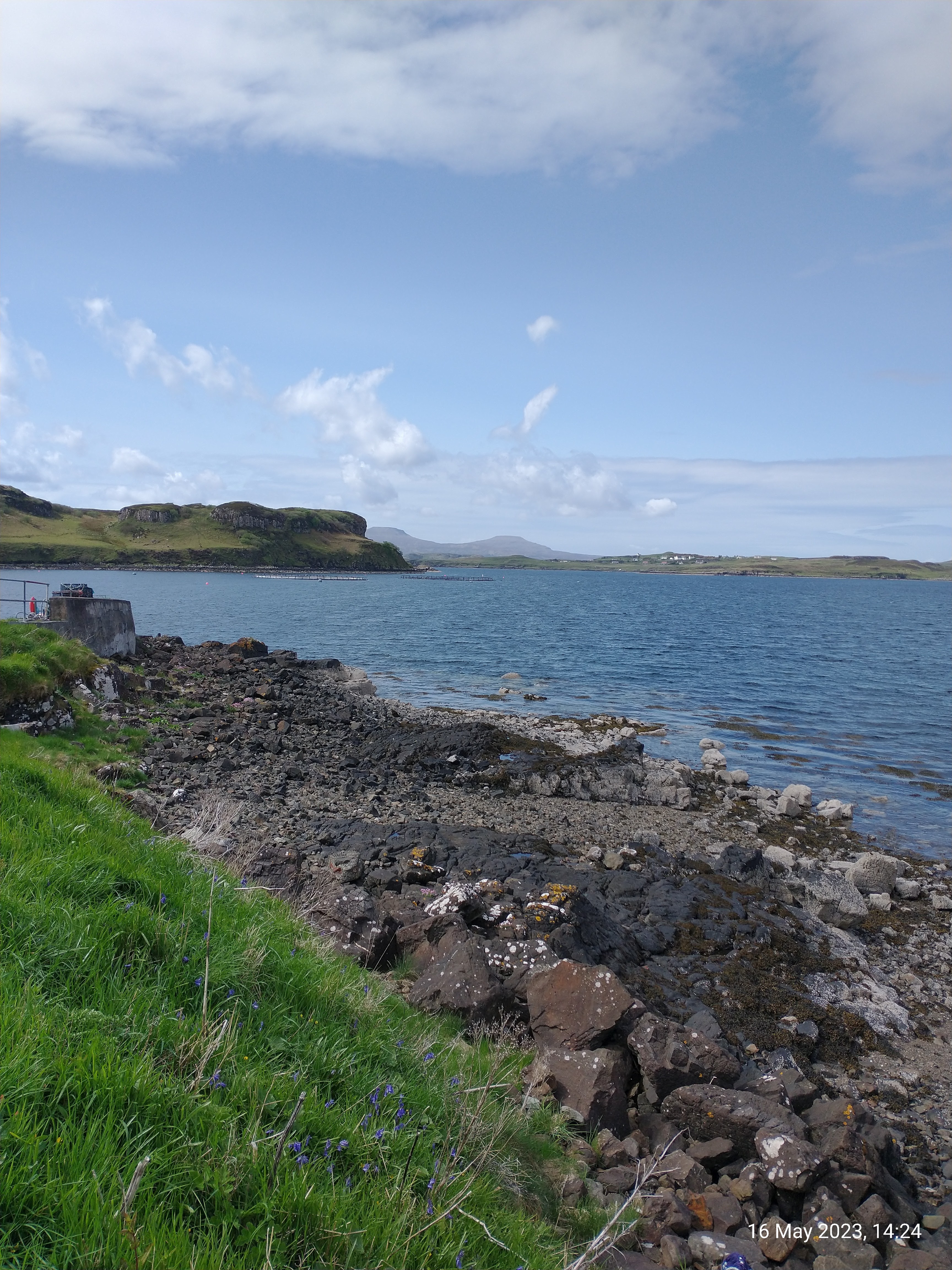
We arrived in port Appin to see this old hulk on the shore, with great views beyond across Loch Linnhe to Lismore island.


Leaving Oban.

Duart castle, famous location of many films etc

Arriving at Craignure.
On the drive to Calgary beach, we came across these old boat hulls.They almost looked like paintings.


We drove through Tobermory and carried on, as it was still early. We wanted to visit Calgary beach at the far north west end of Mull. The little B road was a delight to drive. I was quite getting into this type of driving - like going back in time!
After the pleasant drive, we reached Calgary beach. Remote and wonderfully deserted as we approached it.

We had our eyes on that headland. Perfect day for it!
After exploring the main beach, we decided to walk to the headland we could see.This is looking back from halfway there.
This is the old boat pier. This small pier, constructed with stone from Iona was originally built to allow 'puffers' to deliver coal to the Mornish Estate and was also used to transport sheep to and from the Treshnish Isles for grazing.

The sky was gorgeous now, with high cumulus clouds and a deep blue hue. The sun was also really warm, and the walking pleasant.


There are a set of 5 standing stones but only 2 of these remain standing, the other 3 are lying down. The upright stones are both approximately 2.5 metres high.


After our Calgary beach drive, we drove on to the pretty town of Tobermory. We were staying at a local hotel (very expensive) and going on to Staffa tomorrow, but first - we had to find somewhere to eat!
These are the famous painted houses in Tobermory.


Phionnphort, Staffa, Fingal's Cave,
the Puffins and Iona.
Although the rain abated while we ate our early breakfast, I knew I was missing a treat on the drive to Phionnphort because Sue had done it years ago, and told me about it.The mountains are EPIC around here on a clear day - so I was bitterly disappointed not to be seeing them.
But, were we downhearted? - A bit! We parked up, and boarded our trip boat for Staffa.


Like I said - the clag was still down, BUT it did seem to be clearing slowly.

This guy's dog was getting excited - but of course, they have to be kept under close control on the protected island.


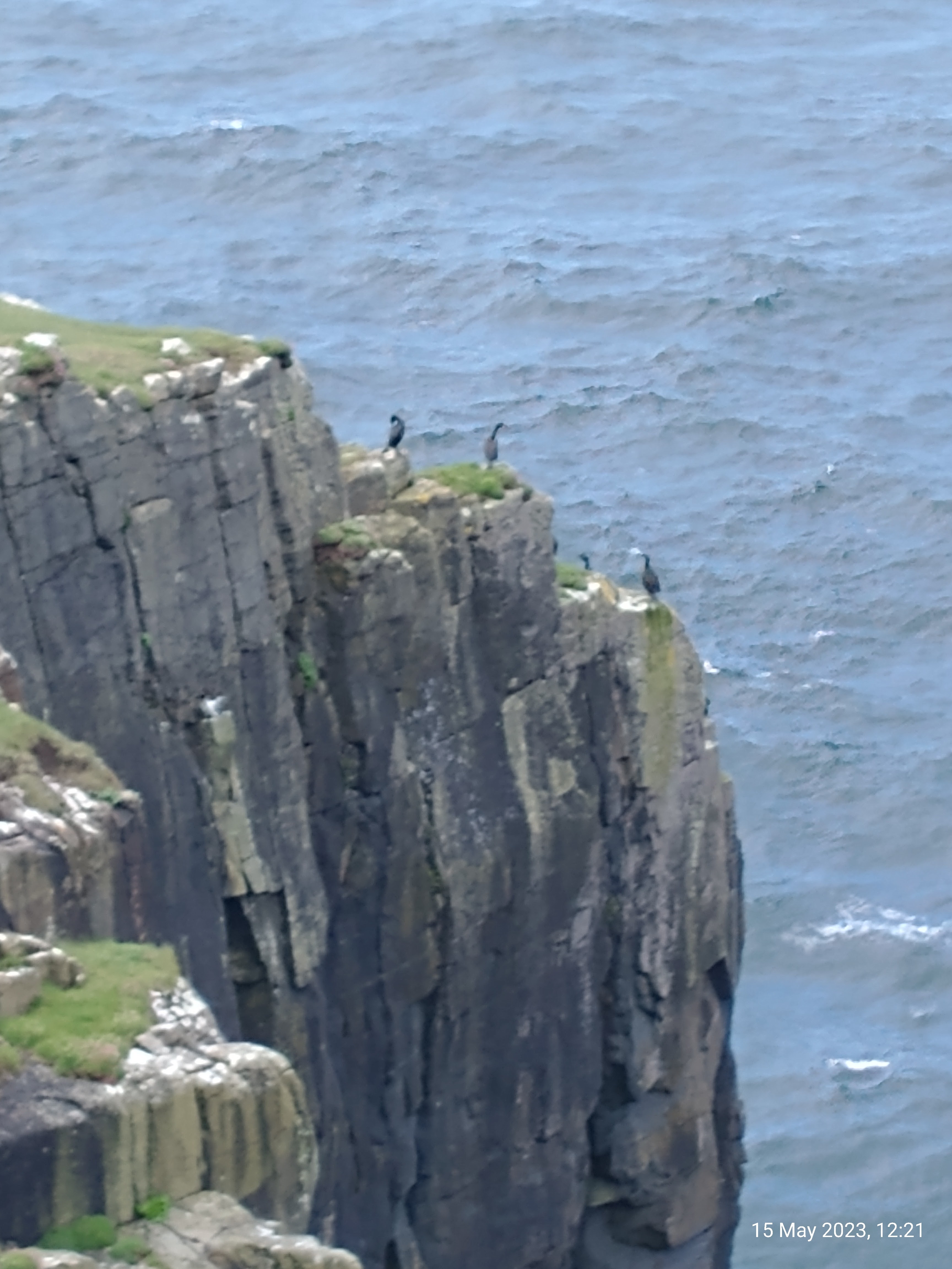
Nature is just so wonderful!


We saw lots of Shag on the rocks, but what we were REALLY here to see was Puffins!
The boat pulled offshore to wait for us while we explored.The rock strata on Staffa is just CRAZY - I've never seen anything else like it.


The sands here are, again, pure white. This photo reminds me of the 'Desiderata' poem :-)


We spent every evening watching the lovely sunsets from here.


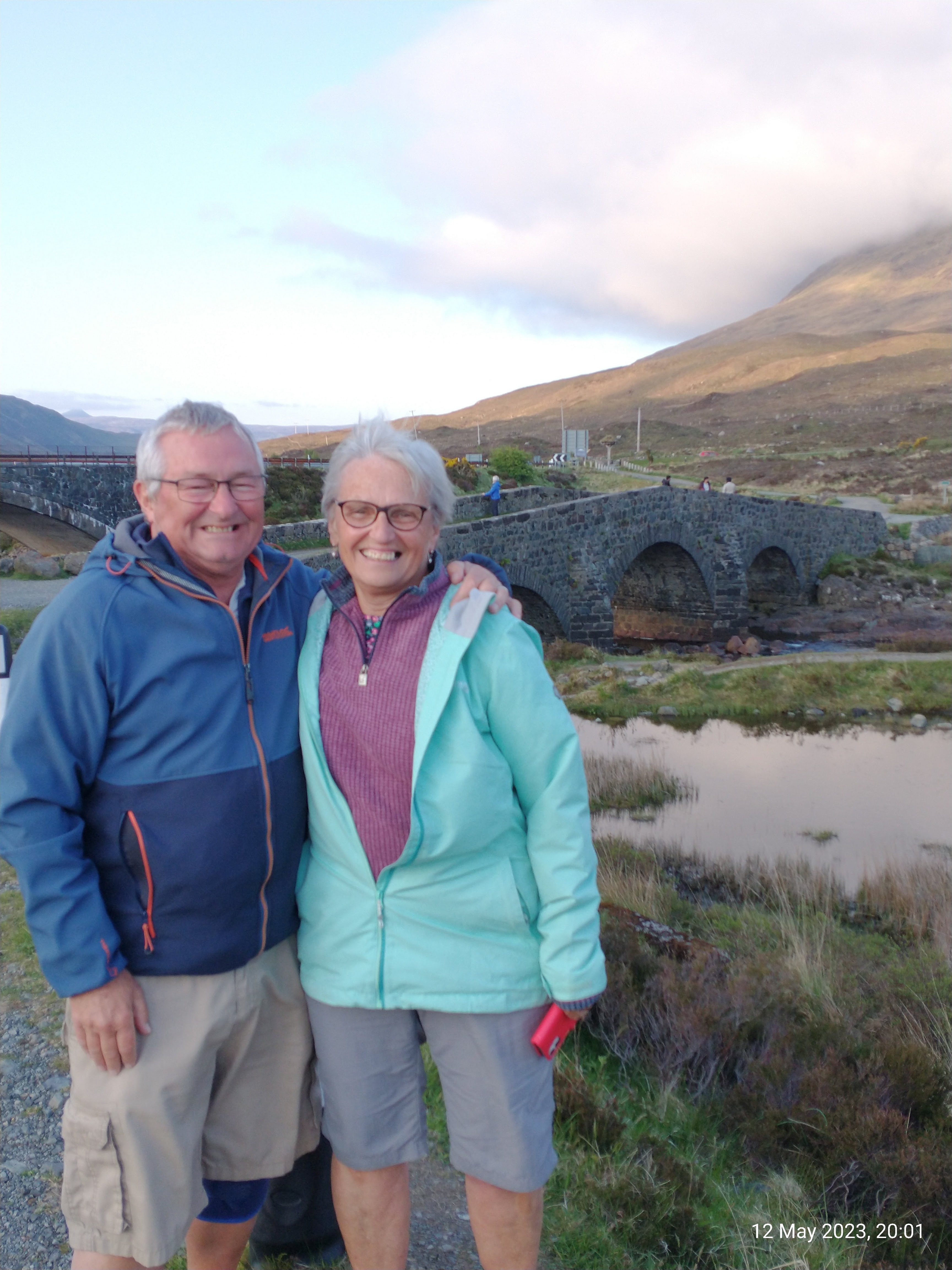
FERRY TO SKYE, SLIGACHAN.
While watching the comings and going of the Mallaig to Fort William steam train, we spotted what we thought was a seal.
To our amazement and delight, we realised it was a sea otter.


.jpg)


PART SEVEN
THE ISLE OF SKYE.
CARBOST, TALISKER DISTILLERY, THE OLD INN, & THE OYSTER SHED.
This is the beginning of our two weeks on the island. We had a long tick list of things we wanted to do. So far, the weather had been kind, and the midges virtually non-existent - result!
We traveled across Skye to our first base on the West coast, Carbost.When we turned off the main road towards Carbost, this fellow greeted us.
And BOY! He wasn't joking!!!
😮


These were, without doubt, the worst roads I'd ever seen! Mind you, it kept speeds down - maybe that's why they don't fix them?
You know things are bad when you can even buy this car sticker!

The site at Carbost is just hard standing. Not pretty, by any standards but served it's purpose. Water & Electric right on the pitch, shower and toilet block, if needed.
The views over Loch Harport were super.


This is looking back to the bay from higher up the path.


Today, we decided to explore closer to home, and take a look at the headland beyond Carbost.
But first, we wanted to visit THE place for seafood around here - the famous oyster shed. We had already been once, but today we went more hungry, hoping for a better selection, as last time they had no mussels, and no prawns.
As you can see - again we were unlucky :-(

We decided on Oysters and prawns. I'm not really a massive fan of oysters, I think they are overrated, but when in Rome.....


However, we did get sorted, and took the track across the fields to Talisker bay. You can see a really high waterfall on the other side of the beach. Yes, we would have liked to go up to it, but the tide was high, and prevented access.


You can read all about it's rich history if you;
After our seafood feast at lunch, it was a huge paradox to find that a weekly fish and chip van was parked up on our campsite!
Of course, with this being Scotland, the local 'delicacy', battered Mars bar, was available. (No - we didn't).

PORTREE AND
THE FAIRY GLEN.
This is the camp site at Portree. It's is a very large site, with all amenities but is all hard standing, as opposed to grass. The views are great, if you pitch on the right looking out to the mountains. There's lots of grass for tents to pitch too.


PART TWELVE.
BROTHER'S POINT, THE MIGHTY QUIRAING, THE SKYE MUSEUM OF ISLAND LIFE, AND DUNTULM.
Today was a REAL gift! It dawned with a beautiful blue sky, so we were eager to get going to walk one of the icons of the island - the Quiraing.
On the drive there, we stopped at a couple of places of interest, of which there are MANY if you ever visit the island. The whole island is dotted with these beautiful crofters cottages.


We parked up and set off, with NO other people around.


PART THIRTEEN
THE STORR, LEALT FALLS AND
DINOSAUR FOOTPRINTS.
Yet another PERFECT day dawned - the weather Gods were with us again, as we drove to walk the Storr. This was the view that greeted us as we approached it.


MORVICH AND PLOCKTON.
After a glorious and rewarding two weeks on Skye, we moved to Morvich to start our journey home. The site was in the wilds, but very, very well run with a place for everything, and everything in it's place. However, it didn't feel at all 'regimented', and the people running it were really friendly. If you needed anything though, it was a trek to the nearest shop or pub, so if you go - go prepared!
This is the super view from our pitch.


The sun played on the few clouds about as we waited for sunset. It was deceptively cool this evening.

PART FIFTEEN
Plockton.
Next day, we made an early start to go to Plockton. Neither of us had been there before, but heard just how beautiful the place was and wanted to see for ourselves. Friends of ours holidayed here many times, and even had their honeymoon here, so if it was good enough for them........
First impressions - WOW!!


GLENCOE AND
THE CLACHAIG INN.
Another move, this time to Invercoe caravan and motorhome park, just outside Glencoe village, for another two night stop.
The view was - well, see for yourself 😍
That little island in Loch Leven has the unusual name of; 'Discussion island'.

This front part of the site was a bit 'car park' and utilitarian, but the view more that made up for it. The pitches behind us on the main site were prettier.
We wanted to go to the famous Clachaig Inn in Glencoe. We've both been there before, and were keen to revisit. There's a path to it right from the site, up behind these houses and through the woods.

The riverside walk is very pleasant, BUT I can imagine it's alive with midges in the season. There were only an odd few knocking about now though (thankfully).

As expected, views to die for all around.

Here's the happy lady - right where she belongs - in the mountains.

I've walked the West Highland Way four times now. It's probably my favourite walk. One time, my brother and I walked the Aonach Egach ridge and, running out of time, were forced to descend via the so-called 'emergency route', which drops right off that big lump on the right, and into the Clachaig - result!


A welcome sight - The Clachaig Inn.


The lounge bar.


This is one of my favourite pictures from the whole holiday.
Peace and serenity personified.


FINAL PART
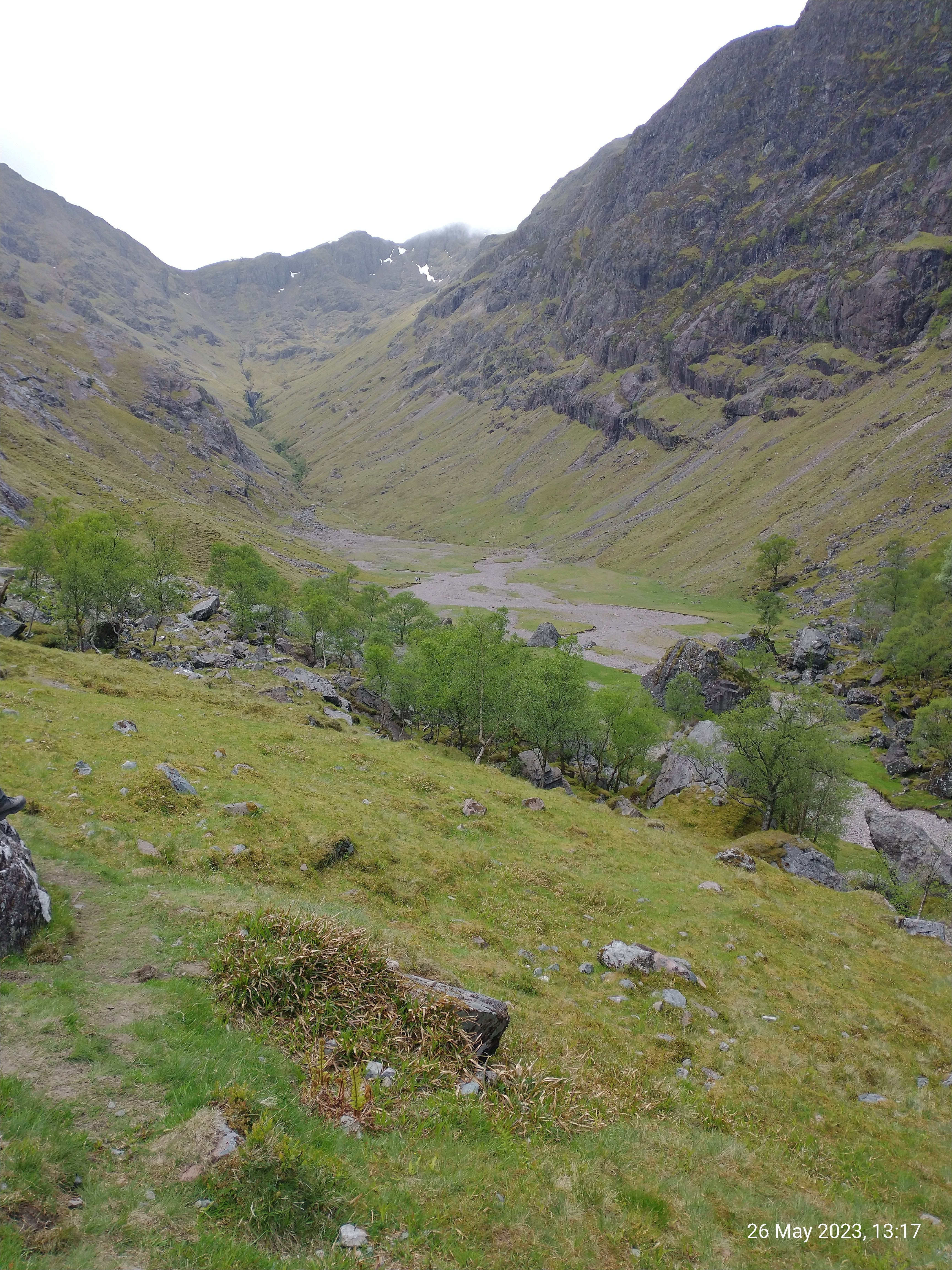
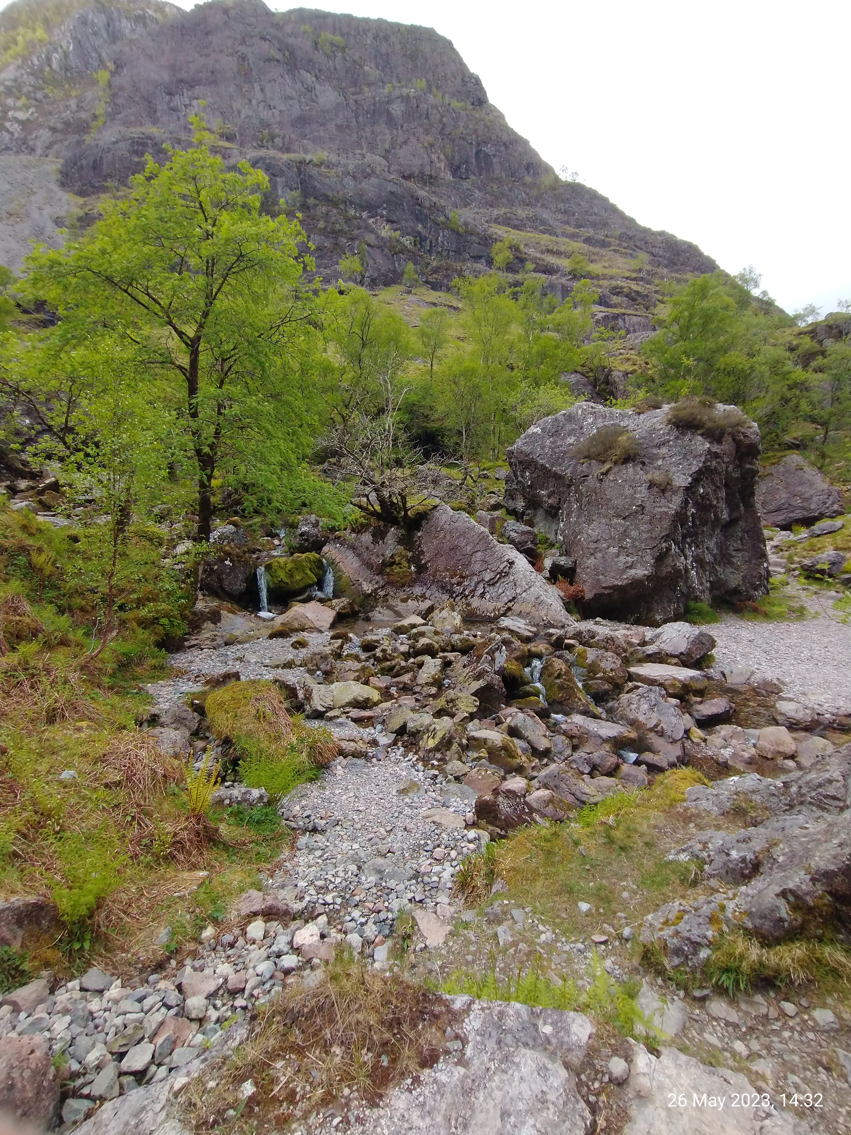
THE HIDDEN VALLEY
& GLENCOE.
This little bubble of a caravan was next to us. We got chatting to the people, and they LOVED it! He was quite tall and, apparently, only just fitted in lying down.


CYPRUS OCT 2022
https://holihoiliday.blogspot.com/2022/12/cyprus-coral-bay-october-2022-two-weeks.html
PARGA JUNE 2022
https://holihoiliday.blogspot.com/2022/08/parga-greece-2022.html
BUDAPEST NOVEMBER 2018
https://biggersteps.blogspot.com/2021/08/budapest-2018-best-pics.html
MALLORCA 2012
https://biggersteps.blogspot.com/2012/11/majorca-part-one.html
GRAN CANARIA 2012 MASPALOMAS
https://biggersteps.blogspot.com/2012/03/gran-canaria-2012-day-one.html
SKIATHOS SEPT 2015
https://skiathos2015.blogspot.com/2015/09/arrival-first-day-16th17th-september.html
CYPRUS CORAL BAY 2018
https://cypruscoralbay.blogspot.com/2020/04/day-1.html
PARGA OCT 2019 (HONEYMOON)
https://2019parga.blogspot.com/2020/04/parga-2019.html
FUERTEVENTURA CALETA DE FUSTE 2013
https://fuerteventurapics.blogspot.com/2013/04/fuerteventura-part-one-getting-settled.html
KEFALONIA CARAVOMILOS 2016
https://kefaloniablog2016.blogspot.com/2019/07/kefalonia-2016-staying-at-karavomilos.html
GRAN CANARIA MARCH 2018
https://gran2018.blogspot.com/2018/04/gran-canaria-2018.html
LANZAROTE 2016
https://lanzarotepics2.blogspot.com/2020/05/lanzarote-2016-part-one.html
MALLORCA 2013
https://www.blogger.com/u/1/blog/post/edit/3574557249150315453/689116775364332226
Krakow 2023
https://holihoiliday.blogspot.com/2023/02/krakow-poland-2023.html